Cape Palliser

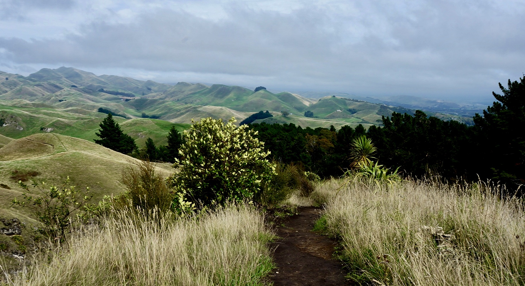
A four and a half hour drive south from Napier is Cape Palliser. It’s at the bottom end of the North Island, and is famous for its cliffs and lighthouse. Happy with our excursion in historic Napier, we were ready to get back into the wilderness, and do some more camping. The spot we chose for camping was Putangirua Pinnacles, which is on the western edge of the Aorangi Forest Park. Always a sucker for parks, cliffs, and lighthouses, this seemed like the perfect destination.

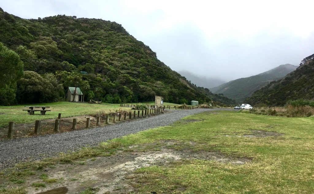
After setting up camp, we decided to head out to see the lighthouse at Cape Palliser. We were also hoping to catch a glimpse of the seal colonies!

The drive along the bay was beautiful. With sea green waves lapping against the coast, it was hard to take your eyes off the sea. The road is somewhat narrow, and there are many signs warning of falling rocks and of “active slip”, meaning we were in a land slide area. There were also plenty of large rocks on the road itself, a reminder that they could fall from the cliffs at any time.

The drive takes you through the little fishing village of Ngawi. camping here is allowed, and interestingly, there appeared to be a souvenir shop. However, there did not appear to be any cafes or grocery stores.

About 10 minutes from the lighthouse, water was streaming across the road. We hesitated, not sure if our rental would make it (a little Yaris). But along came another similarly small car from the other direction, and it seemed to have no problem fording the river. So, inspired, we went through it as well.

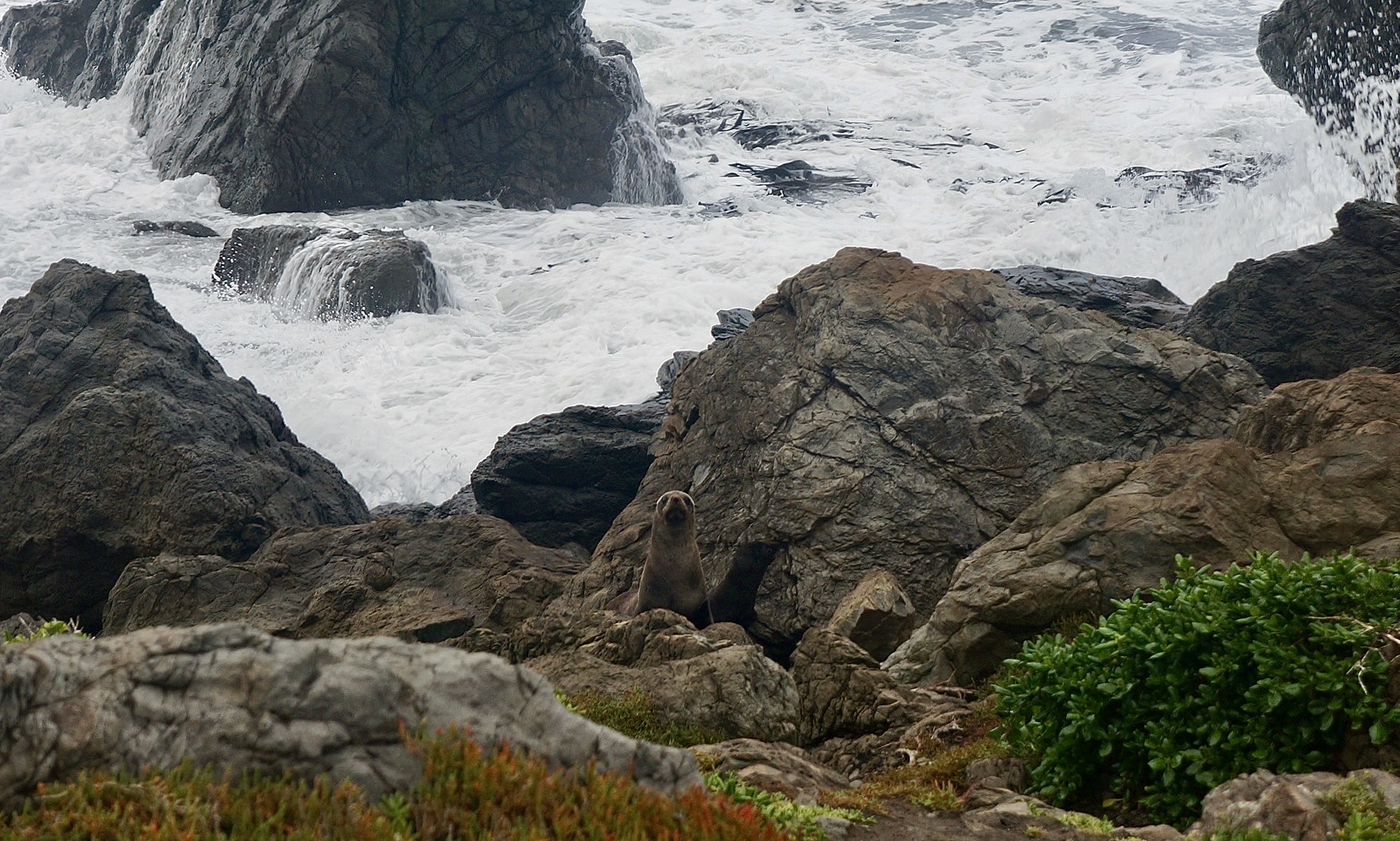
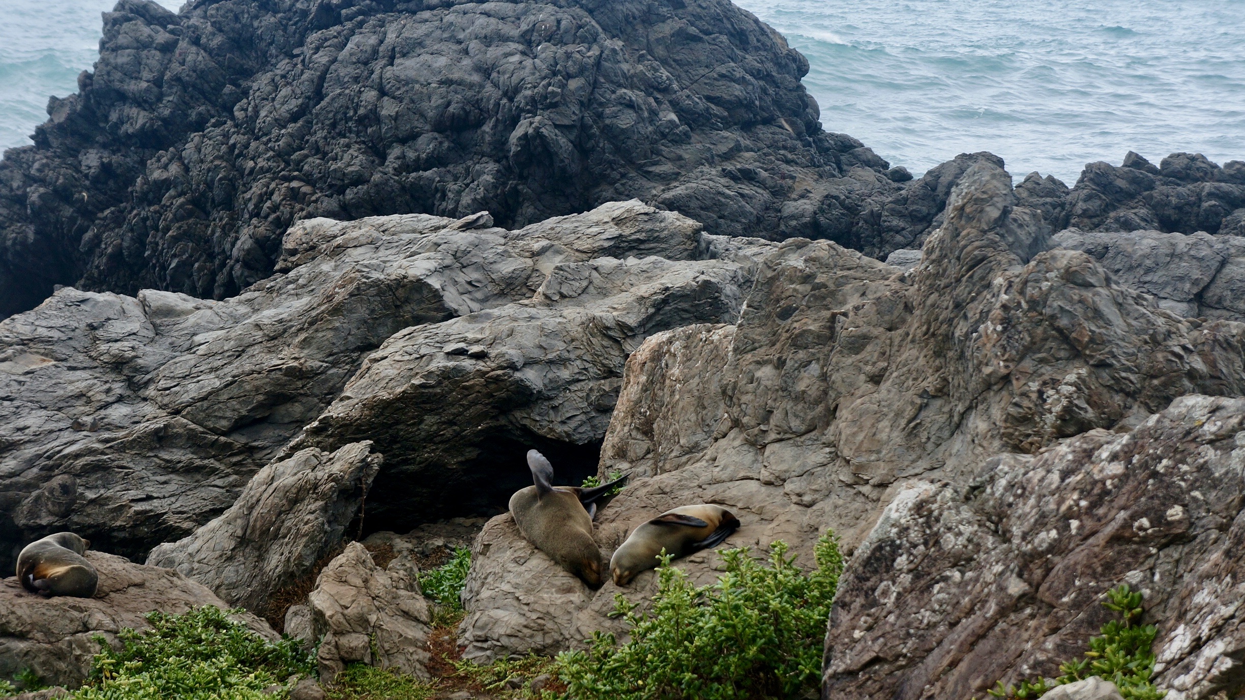
And – good thing we did! Just on the other side were the fur seals! They were hanging out just across from the street. We of course jumped out and took some photos. They looked up at us, but for the most part didn’t really even acknowledge our existence. And we didn’t want to scare them, so we did keep our distance. But I could have spent hours just watching them. And, we did stop twice – on the way to the lighthouse, and then again on the drive back.

Then onwards to the lighthouse. There were a couple of houses along the way, some clustered together, and some on their own. You’d have to be pretty self-sufficient and brave to live all the way out there with the sea crashing all the time. We were still 2 hours from Wellington, and the roads didn’t seem like they were always passable.

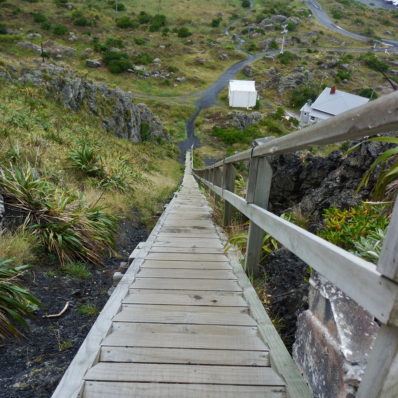
At the lighthouse, which felt like the end of the world, there were two houses. In between the two houses is a path that leads to the 244 steps you climb to get to the platform of the lighthouse.

The views of the sea and the cliffs along the coast were spectacular.

Napier

After our hike, we headed to Napier, and started to look for a place to stay. Now that it was Sunday, there were a lot more vacancies. We settled on a place called Edgewater, which was $145 AUD. It was large place, more of an apartment than a hotel. With two rooms, a little kitchen and a balcony, it felt luxurious. And it had views of the water, and was about a 5 minute walk into downtown Napier.

After we put our belongings down, we left to explore Napier. As predicted, it did rain, so we zigzagged between awnings and stores and other covered areas. When it wasn’t raining, we explored Clive Park, and enjoyed the Art Deco architecture. All over the town, there were before and after photographs of the great earthquake of 1931. After the town was devastated by this earthquake, the government rebuilt it in the style of the time, Art Deco, and they have survived to this day.

That evening we ordered take away from Kilim, a friendly Turkish restaurant. Had the weather been nicer, we would have happily eaten there. But, our balcony was calling to us, and we were hoping to get back before the rain really started to pour. The food was delicious. And, after we finished, it looked like the rain was through, so we were able to enjoy the town at night, including a quiet drink at this gorgeous hotel bar. It was neat to see the town lit up at night!

Hawkes Bay

After our two day car adventure along the Forgotten World Highway, we were ready to stretch our legs. The weather looked iffy in the afternoon, but we figured we had enough time to venture out to Hawkes Bay, and get a hike in.

We didn’t know much about the area, since we had not initially planned to come to the East Coast. But on a brochure we found in our hotel, we read about Te Mata, and decided that after breakfast in Hastings at Cafe Westerman’s, we’d drive out there. Te Mata is a mountain just south of Hastings with a number of different hikes on offer.

Directions showed that it was less than a 20 minute drive away, with relatively few turns – it looked like a piece of cake. Somehow though, we actually did get a little lost along the way. With no data on our phones, and only a cached map, we were initially just following the signs to Te Mata … until the signs stopped.

The drive to Te Mata

For those who are interested in how to get there: We drove through Havelock North, and then continued along Te Mata Road, until it ended. With no signs for the peak, we went right along Waimarama. After another couple of minutes, we decided we must have gone too far, so we circled back and retraced our steps. On the way back, we saw a sign at the third round about, directing us left on Simla Ave. (So, for those coming from Hastings, make a right at the second round about). The road winds through this little suburb, and eventually, you keep climbing higher and higher until you see a sign on the right to park for Te Mata.

Note: If you’re not up for a big hike, but want to enjoy the views, you can keep driving to the top of the peak. There are many trails to choose from, for hikers and mountain bikers alike. We chose the Rongokako Trail, which is 5.5 km long. It’s a loop, with some pretty steep climbs, but it’s only a couple of hours and overall, not too strenuous.

In addition to the breathtaking views, you get to wander among some fairly large redwoods, which felt like a whole separate hike all unto themselves.

The many different trails of Te Mata